Global specialty property and casualty insurer and reinsurerCatlin Group Limited has teamed up with Google Maps to providelandlocked viewers a glimpse into the secret andquickly-disappearing world of coral reefs as part of an initiativeto better understand and insure developing risks.
|Besides being a prime feeding and breeding ground for oceanlife, the insurer says the reefs are a natural risk indicator thatdisplays early signs of global environmental changes. Reefs alsoact as physical barriers that protect vital shoreline propertiesfrom storm surge, which is an increasing worldwide risk due toclimate change.
|“The Catlin Seaview Survey will use new technology to gatherimportant scientific information about coral reefs that has neverbeen previously collected,” says Stephen Catlin, chief executive ofCatlin Group Limited. “Catlin is sponsoring the Survey so that wecan better understand the changes that are occurring to our planet.We believe that the more we understand about what is happening tothe world in which we live, the better we can decide how to insurethe risks we will face in the future.”
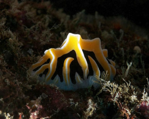
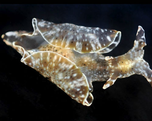
|The following photos are from the Seaview Survey.
||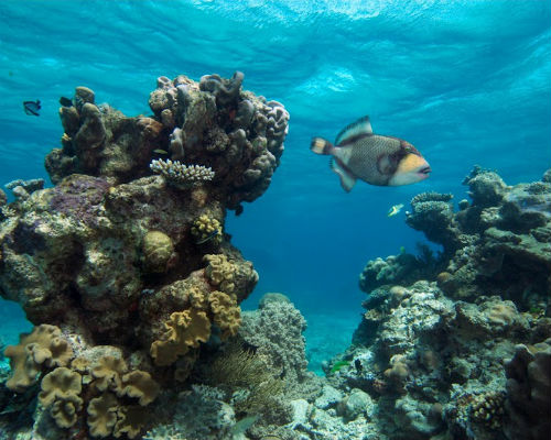
Coral reefs cover less than 1 percent of the Earth's entiresurface, and yet they provide food for over 500 million peopleglobally and produce $375 billion annually through local tourismand fishing. Australia's Great Barrier Reef produces $1.5 billion,and Florida reefs generate $2.5 billion.
||
Ove Hoegh-Guldberg, director of the Global Change Institute atthe University of Queensland, says that the world will lose morefrom eroding reefs than a source of natural beauty. Coastal reefsare a protective barrier between coastal infrastructure and stormwaves, and are an untapped reservoir of material forpharmaceuticals- and we have lost 50 percent of our coral reefresources over the past 30 years.
||
“At the heart of the Catlin Seaview Survey is the principle thatyou can't manage what you can't measure. By giving countries fromall over the world the opportunity to rapidly assess the state oftheir reef resources, this project will allow these countries theimportant baseline and rapid assessment technologies to measure thedirection of change and to prioritize their managementinterventions.”
||
According to the latest National Oceanic and AtmosphericAdministration (NOAA) data, $9 billion of the nearly $30 billionglobal net profit of coral reefs is created by the coastalprotection they provide. Each meter of reef protects about $47,000of property value, and in Florida, a coastline devoid of reefswould submerge large parts of the state.
||
Vanishing reefs also impact popular international touristdestinations. Reefs and mangroves in Belize help the country avoid$231 to $347 million in damages annually. In contrast, Belize'sgross domestic product in 2010 was just $1.5 billion.
||
It is possible to replace coral reef, but it is an expensiveprocess. Artificial breakwater in the Maldives, installed as areplacement for lost reef, cost $12 million.
||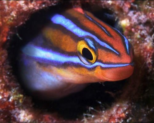
The Seaview Survey's shallow reef team will utilize arevolutionary SVII camera with the ability to take continuous 360degree high-definition images to explore at an average depth of 26feet of water. The images will be GPS located and revisited toassess accurate visual change over time, allowing for accurateregional modeling of the effects of climate change.
||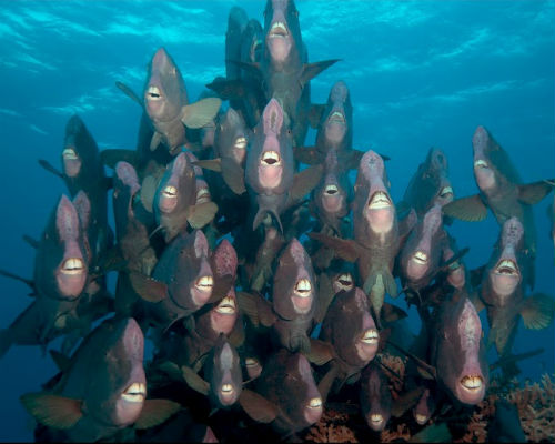
The deep reef mission will go to “mesophotic” depths of 98 to328 feet along the Great Barrier Reef and the Coral Sea. TheSeaview Survey hopes to discover new species of fish and coral andanswer questions about the ecology of deep-sea life, which theCatlin team describes as “a canary in a cave” that demonstratessigns of environmental imbalance.
||
The four locations being explored by the Seaview Survey areHeron Island, Opal Reef, Holmes Reef and Lady Elliot Island, knownfor its large manta ray population. Those following the expeditionscan take a virtual vacation alongside divers as they post abouttheir discoveries on a daily blog.
||
Now is a crucial time for building policies to protect propertyowners from the threat of coastal weather disasters. More than fourmillion U.S. homes along the Atlantic and Gulf Coasts arevulnerable to storm-surge damage, putting the nation at risk ofabout $710 billion in property exposure. The coral reefs alongsoutheastern Florida are the highest in latitude along the WestAtlantic Ocean, and are situated close to the developedshoreline.
|Image source: Google/Catlin Seaview Survey
|More photos of the excursion can be viewed at www.catlinseaviewsurvey.com.
Want to continue reading?
Become a Free PropertyCasualty360 Digital Reader
Your access to unlimited PropertyCasualty360 content isn’t changing.
Once you are an ALM digital member, you’ll receive:
- All PropertyCasualty360.com news coverage, best practices, and in-depth analysis.
- Educational webcasts, resources from industry leaders, and informative newsletters.
- Other award-winning websites including BenefitsPRO.com and ThinkAdvisor.com.
Already have an account? Sign In
© 2024 ALM Global, LLC, All Rights Reserved. Request academic re-use from www.copyright.com. All other uses, submit a request to [email protected]. For more information visit Asset & Logo Licensing.


