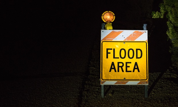
 Properties outside high-risk zones may face more exposure than the maps suggest, leaving residents unaware of their true risk and unprepared for potential loss. (Image: Kim/Adobe Stock)
Flood risk is becoming harder to assess as weather patterns shift, development expands, and major events arrive with less predictability.
Yet many communities still rely on federal flood maps that were designed for a different environment. These maps remain a useful baseline, but they often miss recent land-use changes, evolving storm behavior, and the localized conditions that drive modern flooding. Almost one third of flood claims now occur outside FEMA’s high-risk zones, showing that new strategies may be needed.
That gap has real consequences. Properties outside high-risk zones may face more exposure than the maps suggest, leaving residents unaware of their true risk and unprepared for potential loss. Accurate, actionable information can help homeowners make decisions about mitigation, preparedness, and recovery before flooding occurs.
To keep pace with current conditions, the market needs a clearer view of flood exposure. This requires stronger data, more current modeling, and a practical way to translate insights into preparation steps and post-event support for residents.
The limitations of current federal flood maps
Federal flood maps have long been the baseline for understanding risk in the United States, but many of them no longer reflect today’s realities.
Large portions of the country are still mapped using data that predates major development, new drainage patterns, and the changing behavior of storms. As communities expand and weather becomes more intense, the gaps in these maps grow wider. This leaves homeowners, lenders and insurers working with information that can understate the true exposure of a property.
In many regions, maps have not been updated in years, with some communities relying on maps last revised before recent population growth or major flood events. Just one inch of water can cause up to $25,000 in damage and another $5,000 in mitigation expense, which shows how even moderate flooding can overwhelm households that never expected to face it.
When a map does not align with current conditions, residents may underestimate their risk, skip necessary mitigation steps, and be unprepared when flooding occurs. After a major event, the financial and emotional shock is far greater for families and communities.
These inaccuracies also affect how insurers structure coverage and price policies. When the underlying data is incomplete or outdated, it becomes harder to gauge concentration risks or anticipate the scale of potential losses. Supplemental tools help, but they cannot fully compensate for structural gaps in the current mapping process. Until federal maps catch up to the pace of change on the ground, millions of properties will continue to face hidden or underestimated risks, and homeowners will remain at risk of preventable loss.
Despite the increasing sophistication of risk models, participation in NFIP remains relatively low, and affordability is a major factor. Premiums have risen in many regions, leaving homeowners weighing higher costs against coverage they may not fully understand. In moderate-risk areas, many opt out because they assume they are less exposed than they truly are. Clearer public education about actual flood risk, along with guidance on options like excess and wraparound policies, can help close this gap.
How private flood models fill the gaps
Private flood models have become an important complement to federal maps because they offer a clearer view of how risk is shifting in real time.
These models draw from sources that reflect current conditions, including updated elevation data, recent construction patterns, and the behavior of storms over the past several years. Many also incorporate insights from events that never make it into FEMA’s long update cycle, including totals from more frequent “nuisance” flooding and shifts in local hydrology. This allows residents and communities to identify specific vulnerabilities, take protective measures, and prioritize resources for mitigation.
The value of these tools shows up most clearly in areas that sit just outside the traditional high-risk zones. More than 20% of flood claims come from properties outside these zones, which highlights the limits of relying on a single map. Private models help close that gap by showing the true characteristics of a parcel or neighborhood rather than the broader category assigned to a region.
For residents, these models provide a clearer view of how vulnerable their homes may be, helping them plan for mitigation or temporary relocation. The goal is not to replace federal maps, but to give communities tools that help people act before and recover faster after flooding.
What this means for insurers and policyholders
More accurate data allows homeowners to understand their exposure, make preparedness plans, and take mitigation steps before a storm arrives.
By combining FEMA maps with private modeling, claims professionals and emergency teams can identify at-risk properties, provide early alerts, and ensure support is ready when floods strike, helping residents recover faster and with less stress.
Better information also improves communication with policyholders. When homeowners understand their actual exposure, they are more likely to consider coverage, invest in mitigation, or adjust their long-term plans. Many residents in high-risk areas still do not carry flood insurance, often because they assume they are protected. Private modeling helps close that knowledge gap and guides people toward concrete actions that reduce loss.
Communities also benefit from more current views of risk. Planners can use these tools to guide development, evaluate drainage needs, and prioritize funding for projects that reduce exposure. Earlier insight into shifting conditions strengthens claims readiness overall. When communities understand how risk is changing, they are better able to prepare for a storm, navigate the claims process, and recover more quickly once flooding occurs.
Preparing for the future of flood risk
Flood events are becoming more frequent and more severe, and development continues to move into areas that face rising exposure.
That trend will not reverse, which means the claims industry needs a fuller picture of where water is going and which communities are likely to feel the greatest impact. Federal maps remain useful, but they must be supported by private models and by local knowledge that adjusters and community officials collect on the ground.
Preparedness depends on recognizing risk accurately and explaining it clearly. When homeowners understand the conditions around them, they are more likely to take steps that reduce losses. The purpose of improved modeling is not to create a separate system, but to strengthen the one that already exists. With the right tools, the market can stay ahead of the changes happening in real time and help communities navigate the unexpected.
A clearer and more current understanding of flood exposure is essential to reducing the surprises that follow major events and to helping communities recover more quickly. By equipping residents with actionable insights and ensuring claims support is in place before and after floods, better data and improved modeling make preparedness practical and resilience achievable.
Opinions shared in this piece are the author's own.
Andrew McCallum is Vice President Catastrophe and Flood at Sedgwick, the world’s leading risk and claims administration partner. With over 28 years in the industry, Andrew specializing in claims management and risk solutions. In his role at Sedgwick, he manages risk management and catastrophe planning, where he collaborates with other experts to address risks and support insurance carrier clients.
© Arc, All Rights Reserved. Request academic re-use from www.copyright.com. All other uses, submit a request to TMSalesOperations@arc-network.com. For more information visit Asset & Logo Licensing.