(Bloomberg) -- Don’t underestimate Jose.
|The meteorological gods seem to be working against the hurricaneas Irma’s successor lumbers over the Atlantic Ocean. But it’s sofar out — more than 960 miles from New York — that it’stoo soon to call the all clear.
|“If it is going to be a threat, it is probably a threat nextweek,” said Rob Carolan, a meteorologist at HometownForecast Services Inc. in Nashua, New Hampshire. For now,though, “Jose is having very serious issues.”
|Related: What businesses can learn from Harvey and Irmabefore the next hurricane
|High-pressure system pushing & shoving Jose
Hurricanes can’t move under their own power, and the high-pressuresystem directing Jose Wednesday was pushing and shoving it intomaking a loop around the central Atlantic, said Jeff Masters,co-founder of Weather Underground in Ann Arbor, Michigan. Carolansaid that could have the benefit of robbing the cyclone of muscleas it circles back over its own wake, churning up the cold waterthat saps storms’ strength.
At the same time, the loop could easily turn Jose to pointdirectly at North America, a maneuver that would put about $18.8trillion in property from Maine to Florida in a potentiallydevastating shadow.
|“That sort of behavior is difficult to model,” Masters said.“Especially when you don’t have an accurate picture ofconditions.”
|It may be days before the forecasting image becomes clearer,thanks in part to Irma, said Peter Sousounis, director ofmeteorology at AIR Worldwide,a risk modeler based in Boston. Irma threw out what are calledRossby Waves, which can stretch for thousands of miles. Theyjoggled the upper atmosphere and messed with the steering currentsaround Jose.
|Out to sea or crashing ashore?
Computer models have had Jose passing harmlessly out to sea— or crashing ashore anywhere from North Carolina to NovaScotia.
Related: Is your home in a flood zone?
|The storm was swirling around the Atlantic about 435 miles (700kilometers) south of Bermuda with top winds of 75 mph, as of 5 a.m.New York time. On its current track, high winds could be reachingthe island late Friday as it passes north between there and theEast Coast, the National HurricaneCenter said.
|There is a chance Jose will fall below hurricane strength inabout three days as its top winds dip to 70 mph. Or it could end upin a patch of ocean that would allow it to draw in warm water andbecome more formidable.
|Not enough data
The experts just don’t have enough data yet. While satellites canlook down, the Atlantic isn’t dotted with weather stations that cansend balloons 22 miles into the sky to sample conditions. Andit’s those measurements that make the models accurate.
The U.S. often uses Air Force Reserve and National Oceanic andAtmospheric Administration pilots and crews, called HurricaneHunters, to fly into storms and drop instruments and launch Coyotedrones into the winds.
|One of those hunters discovered that at its peak at 11 p.m. NewYork time on Sept. 8, Jose’s winds reached 155 miles per hour,making it a Category 4 storm and a near rival of Irma.
|100 lives & $135 billion, so far
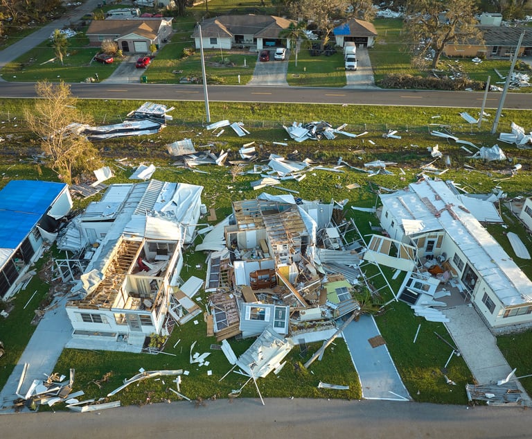
The 2017 Atlantic hurricane season has already claimed at least 100lives and inflicted estimated damage of at least $135 billion fromTexas and Florida to across the Caribbean. Harvey also temporarilyshut about 25% of oil and natural gas production in the Gulf ofMexico and 10% of U.S. refining capacity. Irma subjected Florida’scitrus groves to fruit losses that are just now being tallied.
Related: Irma victims caught off guard seen fuelinginsurers' losses
|If Harvey and Irma offer any lesson, it’s that a storm like Joseneeds to be taken seriously.
|“It could very well intensify again,” Sousounis said. “We cannotturn our heads away from Jose.”
Want to continue reading?
Become a Free PropertyCasualty360 Digital Reader
Your access to unlimited PropertyCasualty360 content isn’t changing.
Once you are an ALM digital member, you’ll receive:
- All PropertyCasualty360.com news coverage, best practices, and in-depth analysis.
- Educational webcasts, resources from industry leaders, and informative newsletters.
- Other award-winning websites including BenefitsPRO.com and ThinkAdvisor.com.
Already have an account? Sign In
© 2024 ALM Global, LLC, All Rights Reserved. Request academic re-use from www.copyright.com. All other uses, submit a request to [email protected]. For more information visit Asset & Logo Licensing.


