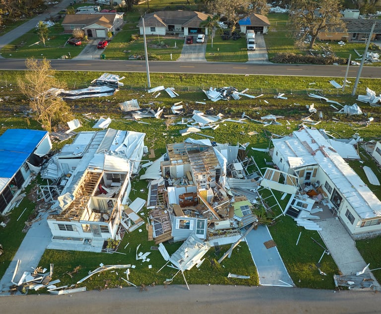
Claims from severe weather such as hailstorms are increasing infrequency and severity, and insurers are taking measures toalleviate the challenges of processing those claims. Aerial data isa key tool that can help insurers reduce inspection times, fightfraud and improve catastrophe response.
|A study from Verisk Insurance Solutions – Underwriting, titled"PropertyHail Claims in the United States: 2000–2013," reveals U.S.insurers handled nearly 9 million hail loss claims valued at morethan $54 billion between 2000-2013. About 70% of claims occurred inthe final six years of the 14-year study, and the average cost perclaim during those six years was 65% higher.
|The increasing size and complexity of claims often lead torising claims-handling costs and longer closing times. Aerial datais helping insurers achieve the seemingly conflicting goals ofcompiling detailed claim files while processing those claimsquickly and effectively.
|Aerial Technology: From a Hot-Air Balloon to RoofDimensions
For centuries, people have taken to theskies to gain valuable perspective from a bird's-eye view. Aerialphotography started in 1858 when Gaspard-Félix Tournachon capturedthe first aerial photo from a hot-air balloon. Since then, aerialimagery has become a staple of cartographers and land surveyorsbecause it helps yield precise maps in a short amount of time.
The insurance industry was a frontrunner in its use of aerialimagery for underwriting and catastrophe analysis. Eventually, someinsurers began to use it to handle individual claims. In recentyears, many insurers have worked with third-party vendors that usecommercial aerial imagery to dimension roofs. It was a bold firststep, resulting in greater efficiencies than traditionalroof-dimensioning methods.
|Insurance-specific Data
As insurers beganto use aerial data extensively, demand rose to capture moredetailed imagery and data about structures and neighborhoods.Computer scientists and geospatial technology and data specialistsbegan to collaborate on new ways to capture and analyzeincreasingly detailed building information. Underwriters can getspecific information about a structure's size, roof material,decks, wall finishes, trampolines, swimming pools and much more.Claims estimators can arrive on-site with dimensions andinformation about roof materials and finishes, which can help themcompile estimates in a fraction of the time it takes from scratch.Soon, insurers will be able to map policyholders in a storm's path,set reserves, dispatch staff and send dimensions and building datawith claim assignments.
Multipurpose Technology
Aerial databenefits insurers and policyholders in several ways. High on thatlist is its potential to save lives, quicken inspections, fightfraud and provide faster policyholder service.
1. Lifesaving tool. The ladder is a perpetualsource of concern for claims managers and insurance executives.Climbing ladders and roofs is inherently dangerous in the best ofconditions. Loss sites may have structural integrity issues, rain,snow, dogs, power lines and many other hazards.
|The United States Bureau of Labor Statistics attributes fallsfrom higher levels, usually off ladders, as the cause for 544fatalities in 2012, the most recent year reported. Thousands moresuffer injuries from similar falls. Insurers are constantlysearching for ways to minimize those dangers.
|Aerial data technology doesn't eliminate the need to examinedamage and assess needed repairs, but it reduces the amount of timespent off the ground. For example, with dimensions and materialidentification in hand, an estimator can inspect a steep roofsystem without climbing from the ladder to the roof—a major causeof accidents. The view from the ladder shows the extent of damageand provides a vantage point for photos.
|2. Loss site visit. Getting comprehensiveaerial data immediately after the first notice of loss quickensloss site inspections. Before arriving on-site, estimators receivea digital diagram of the exterior, including roof dimensions andslopes, information about roof and exterior finishes, and a set ofhigh-resolution aerial images.
|This property data can seamlessly integrate with an adjuster'sclaims-estimating system. Dimensions appear in the estimatingsystem as roof and house plans, noting all exterior dimensions,materials and finishes.
|3. Combating insurance fraud. The NationalInsurance Crime Bureau (NICB) reports that about 10% ofproperty/casualty claims are fraudulent. So, as the number ofclaims from severe weather rises, insurers need efficient ways toidentify suspicious claims.
|Documentation that shows a structure before it was damaged—suchas aerial data that includes up-to-date high-resolution images—isan effective means to fight fraud. In the event of a total loss, asignificant level of detail about the footprint, dimensions, andcharacteristics of the house makes estimating replacement fasterand reduces the potential for disputes.
|4. Premier catastrophe response. Between July 7and July 9, 2014, a massive storm system swept from the Rockies tothe northeast United States, causing more than 45,000 claims andapproximately $350 million in damages.
|Aerial data that included roof and exterior plans led tosignificantly shorter loss inspection times. Adjusters could handlemore claims while providing faster service. Many adjusters reportedhigh policyholder satisfaction.
|Claims professionals were able to start the claims processbefore site visits, which was particularly helpful when access wasrestricted in hard-hit areas. In the aftermath of catastrophes,adjusters can immediately use aerial data to generate roof andexterior plans and even produce a preliminary estimate based on thematerials and expected scope of loss. Once the adjuster inspectsthe loss, that estimate can be quickly amended to match actualdamages.
|Insurance carriers are meeting the challenges of increasinglysevere and more common storms by using aerial imagery to reassessrisk and efficiently handle claims. With aerial data and analysis,they can quicken loss inspections, stymie fraudulent claims andprovide better policyholder service. Future aerial data technologyadvances will help insurers meet the ongoing challenges ofproviding premier claims handling.
|Jeffrey C. Taylor is vice president of Xactware's PropertyInSight group. Xactware is a VeriskAnalytics business.
Want to continue reading?
Become a Free PropertyCasualty360 Digital Reader
Your access to unlimited PropertyCasualty360 content isn’t changing.
Once you are an ALM digital member, you’ll receive:
- All PropertyCasualty360.com news coverage, best practices, and in-depth analysis.
- Educational webcasts, resources from industry leaders, and informative newsletters.
- Other award-winning websites including BenefitsPRO.com and ThinkAdvisor.com.
Already have an account? Sign In
© 2024 ALM Global, LLC, All Rights Reserved. Request academic re-use from www.copyright.com. All other uses, submit a request to [email protected]. For more information visit Asset & Logo Licensing.


