

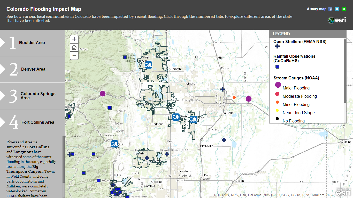
Esri has developed a map to show how variouscommunities in Colorado from Boulder to ColoradoSprings have been affected by the recent flooding, whichhas claimed seven lives and uprooted thousands more. Accessiblehere, the interactive mapincludes information about waterdisruptions and FEMA shelters, along with a linkto the top 50 citizen observations by location.
|
In addition, a public informationmap incorporates flooding information—such aslocations and warning areas, statistics and currentprecipitation—continuously updated by the National WeatherService (NWS) for all U.S. states.
|View related slideshow:Deadly Colorado Flooding Continues To Devastate
Esri notes that visitors to the website can alsoview the real-time effects of the flooding via socialmedia posts. Instructions about how to activate this functionalityare available on www.esri.com.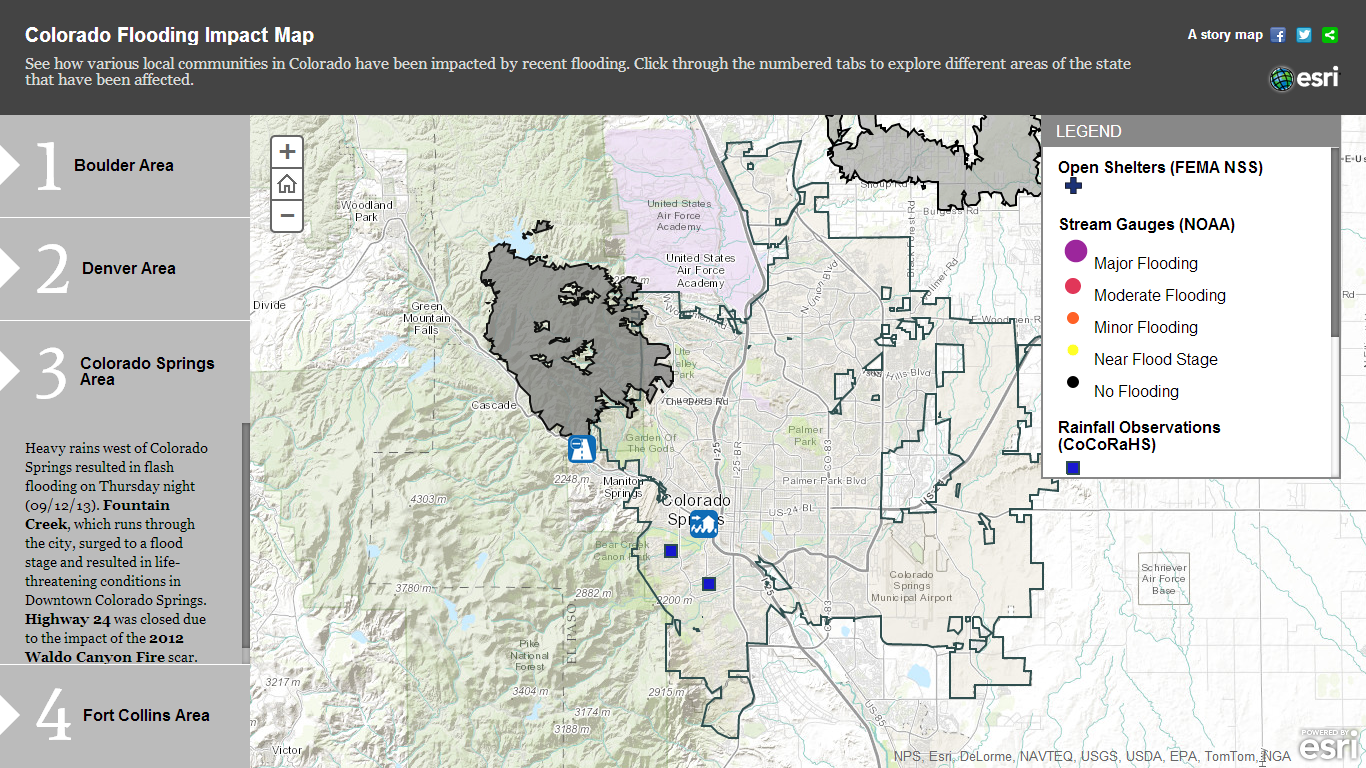
Want to continue reading?
Become a Free PropertyCasualty360 Digital Reader
Your access to unlimited PropertyCasualty360 content isn’t changing.
Once you are an ALM digital member, you’ll receive:
- All PropertyCasualty360.com news coverage, best practices, and in-depth analysis.
- Educational webcasts, resources from industry leaders, and informative newsletters.
- Other award-winning websites including BenefitsPRO.com and ThinkAdvisor.com.
Already have an account? Sign In
© 2024 ALM Global, LLC, All Rights Reserved. Request academic re-use from www.copyright.com. All other uses, submit a request to [email protected]. For more information visit Asset & Logo Licensing.


